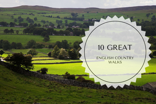
Despite the grey weather, London has always been an attractive destination for expats. The city is home to some spectacular architecture, wide parks and places of art and culture. It is a multicultural, modern city with a bustling population that is always on the move; and as enjoyable as this may be, it’s also precisely for this reason that many feel the need to escape city life for a while, and explore the countryside, where the pace is set by nature itself.The English countryside is almost like a page out of a storybook, and such a rural escape can feel like travelling back in time with visits to crumbling castles and stately homes. Along the way, there are also charming little villages, farmhouses and quaint breweries producing earthy ales. For expats who want to escape the constant hum of city living in London, here are ten great walks in the country.
White Cliffs of Dover
The white cliffs of Dover in Kent are located along the English coastline. The cliffs get their name from their striking appearance caused by the composition of chalk, highlighted by black streaks of flint. An iconic landmark, the white cliffs of Dover offer a peaceful walk with beautiful views. Rich in wildlife and history, the views from the cliffs keep changing.
On sunny days, one can take in the incredible views across the channel, and if the day is very clear, there are also glimpses of buildings in France. On cold days, the cliff-top walk is a hazy but tranquil one. On rainy days, the Visitor Center offers breathtaking views of the waves crashing over the sea wall. The walk along the white cliffs of Dover is an all-weather path with a staggered incline that enables walkers to take short breaks along the way. The path also has a wheelchair-friendly footpath. The cliffs are even ideal for bringing your dog along for a walk. The chalk grassland contains abundant wildlife. There are guided tours to Fan Bay Deep Shelter and South Foreland Lighthouse. Don’t forget to also pay a visit to Mrs. Knott’s tearoom, which has some delicious treats on offer. The nearest station to the White Cliffs of Dover is Dover Priory.
Friar’s Crag
A rocky promontory a little over 0.6 miles from Moot Hall in the town center of Keswick, Friar’s Crag is known for offering stunning views down Derwent Water, the iconic Catbells and the Jaws of Borrowdale. Friar’s Crag is believed to be the place from which monks left for the friary on St. Herbert’s Island.
This walk begins on the outskirts of Keswick and travels along a flat path after lakeside edge. Walkers can choose between the pavement and the shingle. Then comes Cockshot Woods with its abundant wildlife, including red squirrels and birds. The meadow that comes next is often dotted with grazing sheep. One can also spot geese taking a breather from flying all day. The open waterside is a great spot to stop and do some people-watching. The walk continues through some woodland, and at the edge is a bench that overlooks the Lakeland Fells. Here is where you can catch one of the best views in the entire Lake District. There are bus services across Cumbria that will take you to Friar’s Crag. Those with limited mobility can choose to begin at the theatre by the lake.
Hadrian’s Wall Path
A long distance footpath, Hadrian’s Wall Path is located in the north of England and was included in the list of National Trails in 2003. Covering a distance of 84 miles, from Wallsend on England’s east coast to Bowness-on-Solway on the west, much of the walk stays near the remains of Hadrian’s Wall, which was built by the Romans to defend the northern border of the Roman Empire. The spot is now classified as a World Heritage Site. Since the highest point on the walk is just 1130 feet high, it is a relatively easy path.
The wall continues along the remote countryside and through cities and suburbs of Newcastle and Carlisle at some parts. The spot where the wall is most visible is the section between Chollerford and Walton, which is the highest point of the path. Walkers can reach the starting point of the path by taking a local train that runs between Newcastle and the Wallsend Metro Station, from which it is a walking distance. Before beginning the walk, visitors can visit the Roman fort of Segedunum located nearby.
Coleridge Way
Coleridge Way serves as an ideal walking holiday for when you want a breather from the busyness of the city. Two of England’s best-known poets, Samuel Taylor Coleridge and William Wordsworth, walked for miles almost every day, taking in the inspiration of the beautiful countryside. The Coleridge Way path follows those famous footsteps. Starting at the poet’s erstwhile home in Nether Stowey, the walk weaves through the northern parts of the Quantock Hills, exploring the villages of Holford, West Quantoxhead and Bicknoller. It then travels along Brendon Hills, including the villages of Monksilver, Roadwater, Luxborough and Wheddon Cross. The route then passes through the moors of Exmoor and ends at the village of Porlock.
On Coleridge Way, you even get to visit Coleridge Cottage. Throughout the path, there is much to explore from the varied landscapes such as moorland, heathland, woodland, farmland, wooded valleys and quaint villages. Each village has a pub with refreshments for walkers. There are also some tea rooms and village shops to visit along the path. Coleridge Way also has a path for horse-riders that is marked in blue, called the Coleridge Bridle Way, which connects the Quantock Hills and Exmoor.
Crab & Winkle Way
Linking Canterbury with the Whitstable harbor, the Crab & Winkle Way passes through the ancient broadleaved woodland of Blean Woods in the south of Britain, the home of the rare heath fritillary butterfly. The route is mostly traffic-free and follows the railway line from the Winding Pond, which is an ideal spot to have a picnic. There are some hills along the way. The middle part of the route especially is wonderfully undulating, and there follows a 200-foot climb out of Canterbury. The highest point of the path provides some spectacular views over Whitstable.
The Crab & Winkle Way ends at Whitstable station, but the markings continue until the harbor. The seaside town is dotted with weatherboard cottages and has some great seafood on offer. Those who don’t want to walk or ride back can take the train to Canterbury East station, after changing trains at Faversham. There are bikes available for hire, a short distance away from Canterbury station, at the start of the route.
Tarka Trail
The Tarka Trail is a series of footpaths, a cycling route and a railway line, named after the classic novel Tarka the Otter by Henry Williamson. The route follows the path taken by the fictional Tarka the Otter. It spans 180 miles along its figure-of-eight route from the south of Barnstaple to its rural heartland, to the cliffs and beaches in the north, and east into Exmoor. You can join the route by alighting from the train at Eggesford. The walking trail follows an old, unused railway line and provides a flat, traffic path that is great for cycling. The route includes 21 audio posts spread out across the trail, with each post having an information plaque and QR code. The codes, when scanned with a smartphone provide a sound recording that corresponds to a different place along the trail, describing the history, heritage and wildlife of the Tarka Trail. The rest of the path traverses varied landscapes, wooded valleys, moors, sandy bays and coastal cliffs.
Depending on the location along the route, walking can range from easy to moderate, right up to strenuous. Bicycles are available for hire for those who wish to ride along the trail.
Kinder Scout
For those who like a bit of a challenge, the Kinder Scout trail is ideal. The charm of this moorland is in the scaling of its plateau. The upward climb of Kinder is the start of the Pennine Way, which is among the most popular long-distance paths in Britain. Until 1932, Kinder Scout, located between Manchester and Sheffield, was used by grouse shooters and restricted to the public. But with the ‘right to roam’ debate springing up and hundreds of ramblers demanding open access to the moorland, a mass trespass occurred. A clash between the trespassers and gamekeepers ensued as they attempted to climb the plateau. Kinder Scout was later opened to the public, but it was in 2000 that more expansive rights of access came into existence.
Once it opened up, the mass of walkers that followed unfortunately led to the erosion of its peat layer. However, the main attraction for walkers is the stunning views from the plateau, nearly 1970 feet above sea level. Steps are being taken to prevent further damage to the moors. With the help of the public, thousands of cotton grass plants were planted and the eroded peat was re-seeded with heather.
Norfolk Coast Path
The trail goes along the Norfolk Coast Path, starting at the pier at Cromer and continuing along to Cley next the Sea. It is a relaxing route, since it is mostly flat walking alongside the salt marshes. However, there are some undulating parts. Birdwatchers will delight in the abundance of bird species along this walk. The north Norfolk coast is mostly empty even during peak season, and walkers can have long stretches almost to themselves. This route also serves as a great winter walk with scenic cliff-top views.
The walk passes along the seaside town of Sheringham. Next up is Cley next the Sea, where the Cley Marshes nature reserve is located; it is among the top bird-watching sites in the United Kingdom. Along the walk lies a lovely place to stop for lunch or a drink. The Two Lifeboats at Sheringham High Street dates back to 1720 when it was a fishermen’s mission. The Norfolk Coast Path is accessible by the Coasthopper Bus to Cromer that travels via Hunstanton, Sheringham and Cley next the Sea.
Cross Fell
Cross Fell is a circular walk that takes you through wild heather moorland and peat. There are some steep climbs and descents in certain parts. It starts at the little village of Kirkland, ascends Brown Hill, and weaves around the side of High Cap, before ascending again to the Cross Fell summit, which offers outstanding views. The walk goes on to Knock, Little and Great Dun fells along the Pennines, and makes its way back through Milburn, to Kirkland. It’s a long walk, so walkers must remember to carry enough refreshments. The main attraction of this walk is that it is so remote along the north Pennines, which is also called ‘England’s last wilderness’.
Cross Fell is the highest point, at 2930 feet. The stony, flat-top summit overlooks the east and west coasts and the Lake District. Another remarkable view is that of the lush green Eden Valley. From the southeast of the summit, the radar dome on Great Dun Fell is visible. For an overnight stopover, there’s Royal Oak Appleby, a cozy lounge and pub.
Bowerman’s Nose
Bowerman’s Nose is a 10-mile circular walk from the charming village of Widecombe-in-the-Moor and in close proximity to Hound’s Tor, a place which is believed to have inspired author Arthur Conan Doyle to write The Hound of the Baskervilles, one of his most popular Sherlock Holmes stories. Bowerman’s Nose is a famous landmark, known for its granite stack of rocks that resembles a human being with a big nose.
First-time walkers can start walking in from Manaton and on to the moorland road southwards to Hayne Cross. Follow the southwest path to the top of Hayne Down. From the top, Bowerman’s Nose stands beneath you. There are other routes as well to the granite pinnacle of Bowerman’s Nose. There’s one that begins at a pub towards Kestor Inn in Manaton, along the moorland road to Hayne Cross and then up to Hayne Down.